
Roadmap in hand, we set out to find our way along the confusing set of roads that run the length of the spines radiating out from the volcanoes; there are few, if any, reliable crossroads. Get on the wrong ridge road, and you could find yourself much farther away from your destination than where you started. We navigated the network to Pura Besakih, or Mother Temple, partway up the steep slopes of Mount Agung. The last eruption of this behemoth was almost exactly 50 years ago, on March 17, 1963. In that blast, over 2,000 people died and over 10,000 homes were destroyed, though Besakih was untouched by mere meters.
When we were there, we were told that it was a special lucky day—I swear, we must be the luckiest travelers that ever were, because everywhere we go, it’s always a special lucky day!—and that there was a special ceremony going on, and though we’d already paid the entrance fee, we wouldn’t be able to go into the temple proper unless we paid another fee. This fee varied depending upon who you talked to, anywhere from “whatever you want,” to 40 Euros. We decided not to pay the seemingly bogus fee and stick to the perimeter of the temple which we were allowed to explore. Though we didn’t end up coming across any areas that were off limits.
The temple itself is composed of many walled areas—each with many of the Balinese tiered and thatched-roof towers—stretched across a large area as you move further up the mountain. Stunning and picturesque.
After exploring the temple grounds for a while, and seeing the ominous rainclouds getting closer as they got thicker, we decided to head back to the bike, but didn’t make it far before the deluge began. Finding our roadside bamboo grove ineffective for keeping out the rain, we made a dash for a nearby shelter used as a brick-making factory. We stayed there through the worst of it, and would have stayed a little longer had not some local, roving dogs told us, in no uncertain terms, that it was time to move on, rain or not. They did not care that it was our special lucky day.
As we rode higher and higher, the rains eventually turned to mist, then fog, as we arrived at Mount Batur with its lake in the middle of the caldera. We drove along the rim of the caldera, ominous rainclouds on one side, the impressive cone of Batur with its rich, black, volcanic floes on the other. We visited a temple on the ridge (that was relocated from the base of the caldera after being destroyed), where we could hear music from a 3-day celebration ringing loud across the temple.
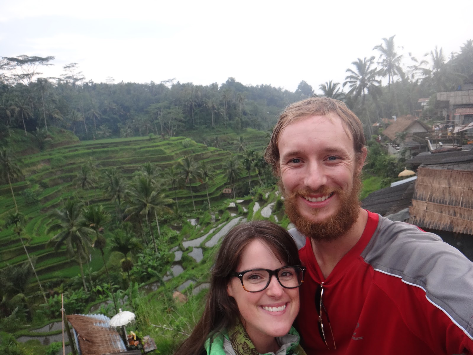
From here it was an easy coast down the volcanic ridge back to Ubud, with a stop at the gorgeous terraced rice fields at Tegallalang. This was an exciting moment for me, because I had had a picture of this exact place as my desktop background for months, and I could remember all the time I spent imagining being there. And now, here I was… I was actually here. Can’t say I didn’t tear up a bit… Ok, this definitely was a special lucky day.


 |
| Our temporary shelter from the rain. |


 |
| Mount Batur in the middle of the caldera. |


 |
| An entreprenurial man kindly took this photo for us; he instructed us to go further and further into the rice field (and away from him and my camera). Just a little farther, keep going, keep going... |

 |
| A view I've been waiting a long time to see... |
Glad you've got a good moto driver there!
ReplyDeleteWhat a view indeed! Such amazing terracing!